Best Infrastructure CAD Training in Hyderabad: Diploma & Advanced Courses
If you’re looking for the best infrastructure CAD training in Hyderabad, you’re on the right track to building a high-demand career in design and infrastructure development. CAD Center Hyderabad provides a detailed guide to infrastructure CAD diploma course, professional diploma course, and advanced diploma course available in CAD Center Ameerpet. Whether you’re a student, working professional, or job seeker, this guide will help you understand the available options, course structure, and career benefits.
What is Infrastructure CAD?
Infrastructure CAD refers to the use of software and digital tools to design, plan, and simulate infrastructure projects like roads, bridges, drainage systems, railways, and highways. CAD software such as AutoCAD, Civil 3D, MicroStation, and Revit is commonly used in this field. These tools help professionals create accurate designs that meet engineering standards and government regulations.
Professionals trained in infrastructure CAD are in high demand in sectors like construction, urban planning, real estate, and public works.
Why Choose Infrastructure CAD Courses at CAD Center Hyderabad?
CAD Center is quickly emerging as a hub for design and engineering education, offering some of the best infrastructure CAD training programs in India. CAD Center Training institute offer industry-aligned curriculum, hands-on training, and access to advanced tools. The city is also home to major construction and civil engineering companies, increasing job placement opportunities post-certification.
By enrolling in our CAD Center Ameerpet, students gain real-time exposure to projects, internships, and job-ready skills that give them a competitive edge.
Infrastructure CAD Training Programs at CAD Center Hyderabad
Infrastructure design focuses on the planning and execution of essential services like roadways, bridges, tunnels, water and sewer systems, communication networks, and utilities. Through advanced CAD and BIM workflows, the programs empower you to create intelligent 3D models and engineering documents that enhance precision, resilience, and inter-disciplinary coordination.
Diploma Courses
Objective: Begin with conceptual layouts and move toward detailed design using AutoCAD Civil 3D for projects such as roads, intersections, and terrain modeling.
Software Covered:
- → AutoCAD Level 1 (2D + basic 3D)
- → AutoCAD Civil 3D
- → Navisworks
Who Can Enroll: Students and professionals in Civil, Architecture, or Construction engineering, as well as project managers.
Certifications:
- → Autodesk Course Completion Certificate
- → Autodesk Online Examination Certificate
- → CADCENTER Course Completion Certificate
Professional Diploma Courses
Objective: Extend foundational skills to include cloud-based BIM coordination with InfraWorks and BIM 360, enhancing project delivery and collaboration.
Software Covered:
- → AutoCAD Level 1
- → AutoCAD Civil 3D
- → InfraWorks
- → Navisworks
- → BIM 360
Certifications: Same as Diploma track
Advanced Diploma Course
Objective: Elevate infrastructure design competencies with advanced tools such as terrain modeling, bridge planning, water network design, and project scheduling.
Software Covered:
- → AutoCAD Level 1 + Civil 3D
- → InfraWorks
- → OpenRail
- → WaterGEMS
- → Navisworks
- → BIM 360
- → Primavera (for scheduling and project management)
Certifications: Same Autodesk and CADCENTER credentials.
Program Overview: Side-by-Side Comparison
Course Level | Focus Area | Key Tools | Certifications |
Diploma | Conceptual to detailed infrastructure modeling | AutoCAD, Civil 3D, Navisworks | Autodesk + CADCENTER |
Professional Diploma | Cloud-based coordination and project management | + InfraWorks, BIM 360 | Autodesk + CADCENTER |
Advanced Diploma | Brings in simulation, water/rail, scheduling | + OpenRail, WaterGEMS, Primavera | Autodesk + CADCENTER |
Career Opportunities After Infrastructure CAD Training
Completing a diploma or advanced diploma in infrastructure CAD can lead to a wide range of career opportunities, such as:
- CAD Draftsman – Infrastructure Projects
- Highway Design Engineer
- Drainage and Sewerage Designer
- BIM Coordinator – Infrastructure
- Urban Infrastructure Planner
- Civil CAD Technician
Hyderabad, being a major metro city, offers roles in government bodies, MNCs, real estate developers, and infrastructure consultancy firms.
Duration and Fees of Infrastructure CAD Courses
Here’s an overview of what to expect in terms of course duration and cost:
Course Type | Duration | Average Fees (INR) |
Diploma Course | 3–6 months | ₹20,000 – ₹40,000 |
Professional Diploma Course | 4–8 months | ₹35,000 – ₹60,000 |
Advanced Diploma Course | 6–12 months | ₹50,000 – ₹90,000 |
Note: Prices and durations may vary based on the institute and the level of customization in the course.
Invest in the Best Infrastructure CAD Training in Hyderabad
If you want to build a solid career in civil engineering, construction design, or urban planning, investing in a diploma, professional diploma, or advanced diploma in infrastructure CAD Center Hyderabad is a smart move. CAD Center Hyderabad offers a strategic advantage with high-quality training center, industry exposure, and job opportunities.
Start your journey today by enrolling in our CAD Center and become a certified expert ready to shape tomorrow’s cities and infrastructure systems.
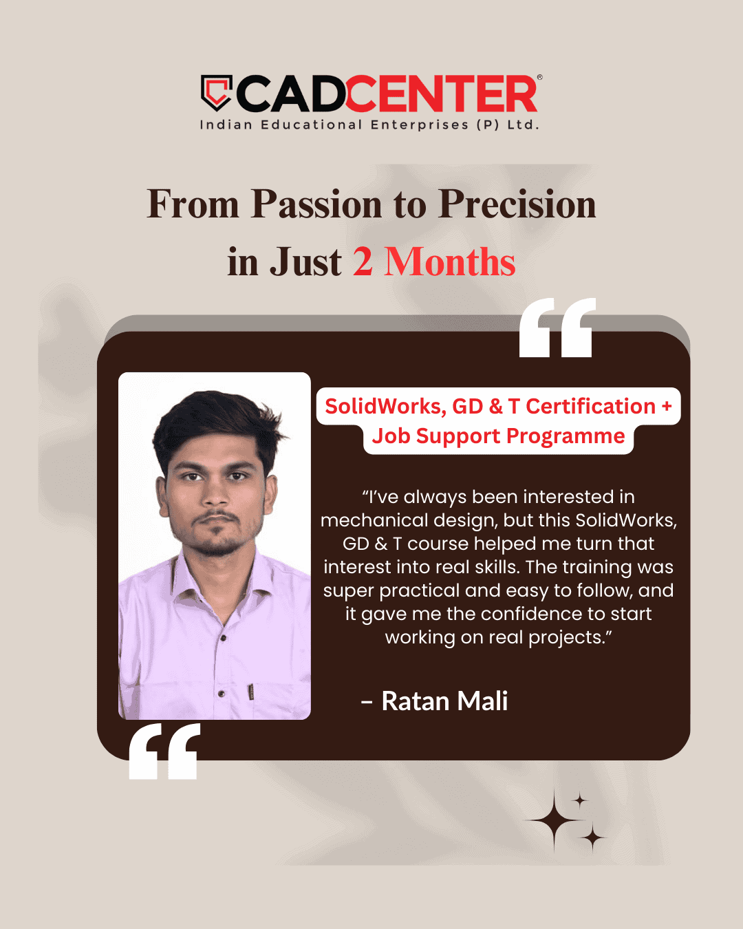
What Our Clients Say


Frequently Asked Questions
Students learn to create detailed city layouts, zoning plans, and utility networks using CAD tools.
This gives practical experience in visualizing and planning urban infrastructure efficiently.
Courses teach modeling terrain, elevations, and site grading for roads and bridges.
Learners gain skills to prepare accurate project layouts and construction-ready drawings.
Students practice drafting bridge components, road alignments, and rail layouts in CAD software.
This develops an understanding of structural and civil engineering integration.
Practical modules include designing pipelines, drainage systems, and site utility plans.
Students learn to integrate these systems into coordinated infrastructure models.
Diploma courses focus on AutoCAD and Civil 3D for drafting, mapping, and basic 3D modeling.
This foundation helps beginners handle standard civil and infrastructure projects.
Professional Diploma introduces advanced 3D site modeling, clash detection, and BIM integration.
Learners gain hands-on experience managing larger and complex projects.
Advanced Diploma covers project simulation, structural coordination, and large-scale planning.
Students learn to manage multidisciplinary workflows and optimize infrastructure designs.
Yes, professionals can improve drafting speed, design accuracy, and coordination efficiency.
Advanced modules allow them to handle complex civil and infrastructure projects confidently.
Students work on practical assignments simulating urban roads, bridges, and public utilities.
This prepares learners for actual design challenges encountered in construction projects.
Diploma courses start with basic drafting skills, while Professional and Advanced levels require fundamental CAD understanding.
Structured learning ensures smooth progression for all learners.
Students learn integrated modeling techniques, coordinating civil, structural, and site systems.
This reduces errors and enhances efficiency in multidisciplinary projects.
Graduates can work as Civil CAD Designers, BIM Coordinators, Site Planners, or Project Engineers.
Advanced diploma holders can take senior roles in infrastructure planning and execution.